Bucks County Land Cover Change
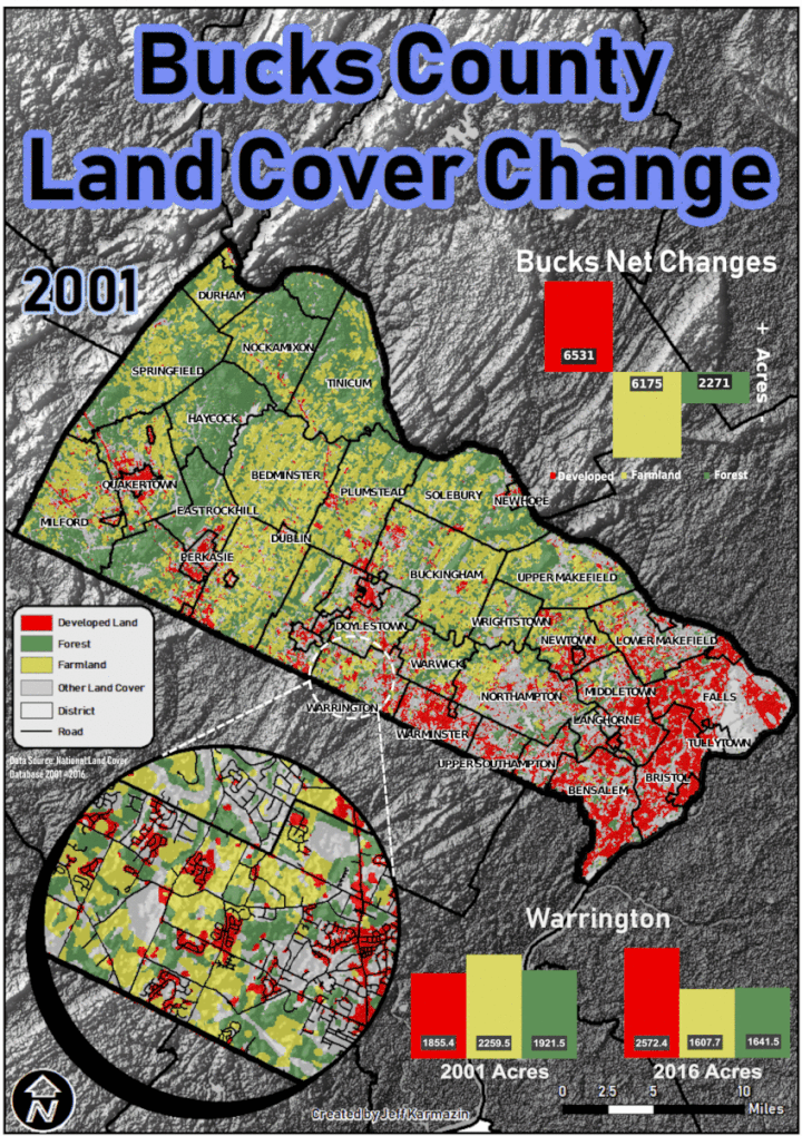
Examining National Land Cover Database raster data from years 2001, 2006, 2011, and 2016. NLCD data is reclassified into 3 categories for analysis; Developed Land, Farmland, and Forest. Initial statistics for each category were calculated per district in Bucks County for 2001, then again for 2016. The net differences were calculated to find which districts had the biggest changes in landcover.
In the end, Warrington Township was found to have gained the most Developed Land, while losing the most Farmland and Forest. Specifically, over the 15 year period analyzed, Warrington Township gained 717 acres in Developed Land, lost 652.8 acres of Farmland, and lost 280 acres of Forest. Developed land went from 21% of the land cover in 2001 to 29% in 2016.
As for all of Bucks County, Developed Land increased by 6531 acres. Farmland decreased by 6175 acres. Forest decreased by 2271 acres.
In conclusion, it is safe to say though suburban growth has slowed since it’s explosion decades ago, the suburbs of major metro areas are still growing. Former Farmland and Forested areas provide opportunities for further expansion as our population ever increases.